
MELBOURNE, Australia — The 2026 El Niño has broken a major climate record, with Australia's Bureau of Meteorology confirming that warming across the tropical Pacific has surpassed the highest weekly reading recorded during the powerful 2015–16 event — and forecasters warn the event may still strengthen toward a historic peak in November or December.

Illustration: Warm water spreads across the tropical Pacific as the 2026 El Niño breaks the 2015 weekly record.
What Happened
On 27 October 2026, Australia's Bureau of Meteorology announced that its weekly relative Niño3.4 index had reached +2.88°C for the seven days ending 25 October. That is the highest value in the Bureau's weekly monitoring dataset, which dates back to 2008, and it exceeds the previous record of +2.78°C set in November 2015. Earlier in October, a reading of +2.81°C for the week ending 11 October had already broken the 2015 mark — making the latest figure the second record in a single month.
The figures measure unusual warming in a monitored region of the Pacific relative to the wider tropical oceans, rather than a direct reading of the ocean's temperature. The Bureau uses this relative method to identify El Niño conditions while accounting for the broader warming of the world's oceans. The distinction matters: it is what allows forecasters to separate the distinctive Pacific warming of an El Niño from the longer-term rise in global sea temperatures.
The atmosphere is responding strongly to the warm water beneath it. Trade winds, which normally push warm surface water westward toward Indonesia and Australia, have weakened or reversed across parts of the tropical ocean. Cloud formation has increased over the central and eastern Pacific, while reduced cloud cover has been observed around Indonesia and surrounding regions. The Bureau recorded a Southern Oscillation Index of -16.6 for the 30 days ending 25 October, far beyond the -7 threshold associated with El Niño conditions — a sign of a substantial shift in air-pressure patterns across the tropical Pacific.
Further evidence of exceptional warming has been found beneath the surface. NOAA reported earlier in October that parts of the eastern tropical ocean contained subsurface water more than 10°C warmer than normal at particular depths. Those extremes were observed in specific underwater regions and do not mean the entire Pacific has warmed by that amount, but they reveal large volumes of unusually warm water below the surface that can feed further warming as ocean circulation redistributes heat in the coming weeks.

Illustration: Australia faces a hot summer outlook as the Bureau of Meteorology warns of above-average temperatures nationwide.
Background
El Niño is the warm phase of the El Niño–Southern Oscillation, a natural climate pattern driven by unusually warm surface water in the central and eastern equatorial Pacific. When it strengthens, it shifts tropical rainfall, alters atmospheric circulation and influences temperatures, drought and flooding across entire continents.
The 2015–16 El Niño was one of the strongest events in modern climate records, alongside the major episodes of 1982–83 and 1997–98. Those events caused major changes in atmospheric circulation, influencing rainfall, drought and temperatures across numerous countries. The current event has now surpassed the 2015 weekly reading in Australia's modern dataset — but it has not yet exceeded the strongest events in the longer monthly records used for historical comparisons. A single exceptionally warm week does not, on its own, establish that an entire El Niño event has become the strongest ever measured.
The 2026 event is also developing against a background of unusually warm seas. According to the Australian Bureau, September 2026 was the warmest September recorded for global sea surface temperatures in its dataset, averaging 1.02°C above the 1961–1990 reference period. BBC reporting cited in analyses of the event also described a daily sea-surface temperature record in the central-eastern Pacific — 3.05°C above average on 19 September, beating the 3.02°C mark from 2015. That is why monitoring agencies increasingly rely on relative indices, which strip out some of the background warming to isolate the El Niño signal itself.
International forecasters are now watching whether the exceptional weekly measurements can be sustained long enough to establish a historic monthly or seasonal record. Australia's weekly monitoring series begins in 2008, while reliable monthly records allow comparisons extending back to 1950. The most recent weekly reading has already surpassed the previous 2015 high within the Australian series; the monthly figures, however, remain below the strongest historical observations — meaning the predicted record still depends on how ocean temperatures develop during November and December.
Why It Matters
The World Meteorological Organization's latest outlook identifies several regions facing elevated risks in the months ahead. Parts of East Africa are expected to experience wetter-than-normal conditions during the October-to-December rainy season, increasing concerns about flooding. Southern Africa faces an increased likelihood of dry conditions as its main rainy season begins in November, potentially affecting agricultural production and water availability. Southeast Asia is expected to experience unusually warm conditions and rainfall shortages, raising concerns about heat exposure, dry vegetation and additional pressure on water resources.
Across the Americas, the forecast presents another complicated pattern. Parts of the northwestern United States and western South America are expected to experience increased rainfall, while sections of Central America, the southern Caribbean and the Amazon face a heightened risk of drought. Powerful El Niño events shift large areas of tropical rainfall, and while the strength of an event does not determine exactly how severe the effects will be in every country, particularly powerful events increase the likelihood of substantial changes to established seasonal weather patterns — with consequences for agriculture, water supplies, food production and flooding.
Australia faces its own unusual combination of climate risks as summer approaches. On 29 October, just two days after the record announcement, the Bureau of Meteorology released its latest long-range forecast covering November 2026 to January 2027. It warned that daytime temperatures are very likely to exceed normal levels across almost the entire country, with the probability of above-average maximum temperatures exceeding 80 per cent across most regions. Unusually warm overnight conditions are also expected to become widespread — the Bureau estimates that much of Australia has more than an 80 per cent probability of unusually warm nights during the three-month period, more than four times the normal likelihood. The prospect of persistently elevated overnight temperatures matters because prolonged heat becomes more dangerous when temperatures remain high after sunset: buildings retain heat, outdoor conditions offer less relief and repeated hot nights increase the strain on vulnerable people.
Rainfall presents a more complicated picture than the widespread drought often associated with El Niño. Australia's latest forecast indicates that parts of western, central and eastern Australia are likely to experience above-average rainfall between November and January, with central and southern Queensland, northern New South Wales and parts of southern Australia carrying probabilities ranging from 60 per cent to more than 80 per cent for wetter-than-normal conditions. Meanwhile, Tasmania, parts of southern Victoria and sections of Australia's tropical northern coastline are more likely to experience below-average rainfall. The Bureau has stressed that El Niño is only one of several factors affecting Australian weather, with a developing pattern in the Indian Ocean also altering where moisture is carried and where rainfall develops.
Ocean temperatures surrounding Australia are adding to the complexity. The Bureau reported that waters around much of the country's western, southern and south-eastern coastline were up to 3°C warmer than average during the week ending 25 October, with further warming forecast in Australian waters during the coming months, particularly toward the north and within the Coral Sea. Warmer seas can supply additional moisture and energy to developing weather systems, potentially increasing rainfall intensity when suitable atmospheric conditions are present, and the Bureau has identified an elevated risk of marine heatwaves in parts of the Australian region.
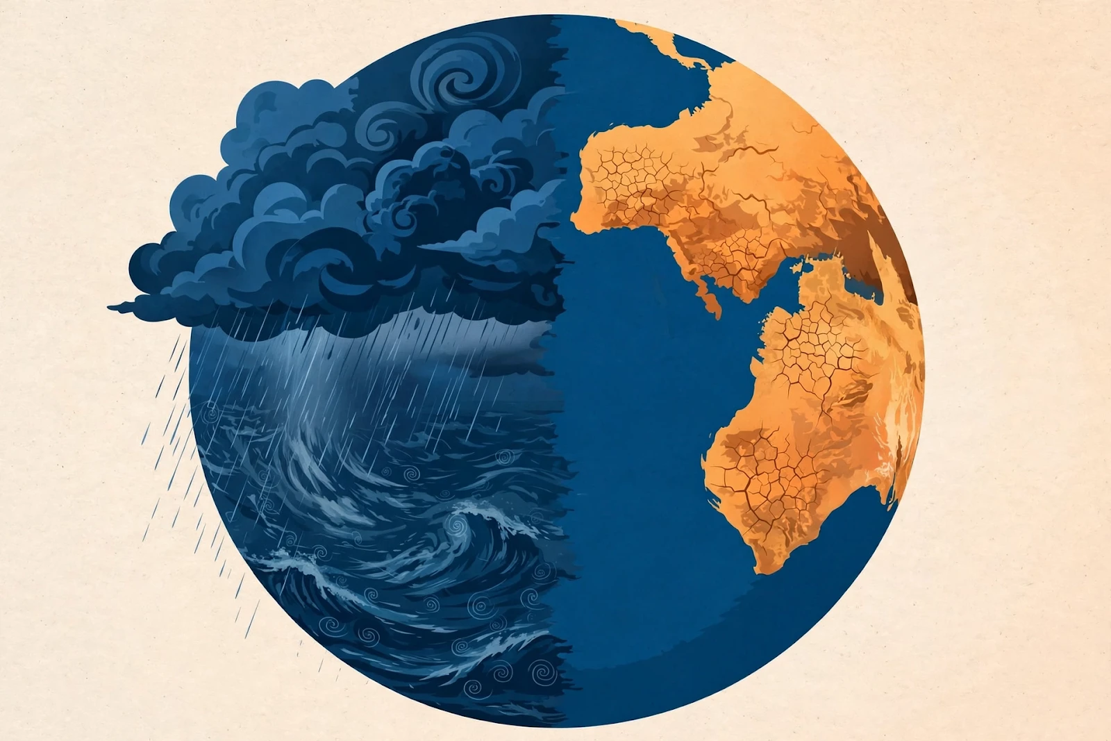
Illustration: El Niño shifts weather worldwide, bringing flood risks to some regions and drought to others.
What Happens Next
The strongest warnings concern the coming two months. Australia's Bureau of Meteorology reports that every international climate model it assesses, including its own forecasting system, predicts further warming of the tropical Pacific. The models indicate that El Niño is likely to reach its greatest intensity during November or December, with monthly measurements potentially exceeding the highest levels observed since reliable records began in 1950.
The United States National Oceanic and Atmospheric Administration issued a similarly striking forecast in its 8 October assessment, calculating an 83 per cent probability that the October-to-December period would reach historic El Niño strength using its three-month relative temperature index, and placing the probability of reaching that level during November to January at 70 per cent. Its forecasts indicate that strong to very strong El Niño conditions could continue through the first three months of 2027. The World Meteorological Organization, in an update published on 26 October, reported that Pacific sea surface temperatures could average approximately 3.8°C above their reference levels during November 2026 to January 2027 — a forecast that uses a different measurement method from the Australian weekly index but independently points toward exceptionally strong conditions. The WMO warned that the event could become unprecedented in strength, with weather impacts potentially continuing long after ocean temperatures begin to decline.
Duration is another important consideration. The Australian Bureau's latest assessment indicates that El Niño conditions are likely to remain established into the Southern Hemisphere's autumn of 2027, and NOAA also expects strong to very strong conditions to continue through January to March. Even if ocean temperatures begin declining after December, the atmospheric changes associated with El Niño can continue influencing seasonal rainfall and temperature patterns for months — which is why international forecasts extend well into next year rather than concentrating exclusively on the current record. The next monthly observations will establish whether the record-breaking weekly measurements develop into one of the strongest sustained El Niño events in the modern historical record. The timing adds a further dimension: the UN climate conference COP30 opens in Belém, Brazil, on 10 November, just as the event approaches its expected peak.
Sponsored: explore today's featured sponsored offers
FAQ
What exactly broke the record?
Australia's Bureau of Meteorology announced on 27 October 2026 that its weekly relative Niño3.4 index reached +2.88°C for the week ending 25 October — the highest value in its weekly dataset dating back to 2008, surpassing the +2.78°C record set in November 2015 during the last major El Niño.
Does this make the 2026 El Niño the strongest ever?
Not yet. The record applies to the Bureau's weekly series, which begins in 2008. The longer monthly records, which allow comparisons back to 1950, have not yet been exceeded. Whether this becomes one of the strongest sustained events on record depends on ocean temperatures through November and December, when the event is expected to peak.
What is the relative Niño3.4 index?
It measures warming in the central equatorial Pacific relative to the wider tropical oceans, rather than as a raw temperature. The relative approach helps forecasters separate the distinctive Pacific warming of an El Niño from the longer-term rise in global ocean temperatures, which is why agencies increasingly use it for historical comparisons.
What does this mean for Australia's summer?
The Bureau's November 2026 to January 2027 outlook warns that daytime temperatures are very likely to exceed normal levels across almost the entire country, with unusually warm nights also widespread. Rainfall is more mixed: parts of western, central and eastern Australia may see above-average rain, while Tasmania, parts of southern Victoria and the tropical north coast lean drier.
When will El Niño peak, and how long will it last?
Forecasters expect the event to reach its greatest intensity in November or December 2026. NOAA expects strong to very strong conditions to continue through January to March 2027, and Australia's Bureau says conditions are likely to remain established into the Southern Hemisphere's autumn of 2027, with weather impacts lingering even after ocean temperatures decline.
Sources
- Australia's Bureau of Meteorology, climate driver update, 27 October 2026
- Australia's Bureau of Meteorology, long-range forecast, November 2026 to January 2027, 29 October 2026
- US National Oceanic and Atmospheric Administration (NOAA), El Niño outlook, 8 October 2026
- World Meteorological Organization, El Niño update, 26 October 2026
- Above the Norm News, "El Niño Breaks 2015 Record as Forecasters Warn Pacific Warming Could Reach Historic Levels", 31 October 2026 — https://www.abovethenormnews.com/2026/10/31/el-nino-2026-record-australia/
- Tim's Weather, Bureau of Meteorology-based analysis of Australia's wet conditions during El Niño, 29 October 2026 — https://timsweather.au/why-is-australia-so-wet-during-el-nino-2026
Comments
Post a Comment