
NEW GUINEA — Fires sweeping across the island of New Guinea have released record levels of carbon as a strong El Niño drought parches the landscape, NASA reported on October 22, 2026, with smoke shrouding large parts of the island for weeks, closing schools, disrupting flights and forcing children and older people to wear masks.
The fires, which burned through September and October 2026, have hit both sides of the island: Papua New Guinea in the east and Indonesian Papua in the west. Satellite data show that by October 17, fires in Papua New Guinea alone had released nearly 32 million tonnes of carbon — more than in any previous year at the same point in the calendar — while Indonesian Papua had passed 35 million tonnes, according to the Global Fire Emissions Database (GFED).

Illustration: Thick wildfire smoke streaming from a tropical island coastline, with fire fronts along the forest edge.
What Happened
NASA's Earth Observatory reported on October 22, 2026, that drought had gripped New Guinea amid a strong El Niño, and that fires had scorched the island while smoke shrouded large swaths of it for weeks. The Visible Infrared Imaging Radiometer Suite (VIIRS) aboard the NOAA-20 satellite captured an image on October 11, 2026, showing thick smoke streaming from the southern part of the island.
In recent weeks, soaring air pollution delayed and cancelled flights, closed schools and prompted officials in some areas to urge children and older people to wear masks, NASA reported. Robert Field, an associate research scientist at NASA's Goddard Institute for Space Studies and Columbia University, explained that while some smoke is washed out by thunderstorms or lofted into the upper troposphere, a lot of it stays near the surface and causes air quality problems. "It's a horrible situation," Field said, according to NASA.
The emissions figures underline how exceptional the season has been. According to GFED, fires in Papua New Guinea had released nearly 32 megatons of carbon by October 17, more than any other year on record at that point in the year. Guido van der Werf, a fire scientist at Wageningen University & Research, said emissions were already much higher than the 2015 total for the year, and that it was very likely 2026 would become the highest year on record for Papua New Guinea, even surpassing 1997.
On the Indonesian side of the island, fire-related carbon emissions had surpassed 35 million tonnes, NASA's reporting noted — the third-highest figure on record there, behind only 1997 and 2015, both also major El Niño years. The contrast with western Indonesia was striking: fire activity in Sumatra and other western regions was relatively lower than in previous drought years, while Papua, Papua New Guinea and eastern Indonesia saw exceptionally high activity, according to researchers cited by NASA.
Background
New Guinea, the world's second-largest island, holds an extraordinary variety of plant life across more than a dozen distinct ecoregions, including seasonally dry savannas, tropical rainforests and lowland swamp forests, NASA noted. That diversity is part of why the fires matter far beyond the island: the forests store vast amounts of carbon, shelter unique species and regulate water and rainfall for communities across the region.
El Niño, a recurring climate pattern linked to unusually warm surface waters in the central and eastern tropical Pacific, shifts rainfall patterns around the world. In New Guinea it often brings reduced rainfall, particularly to southern regions that already experience pronounced dry seasons. In 2026 the drought was especially severe: parts of southern Papua New Guinea went more than 90 consecutive days without rain, and since August some areas received only about 5 to 10 percent of their normal precipitation, according to reporting on the NASA data.
People also light many of the fires. Local communities burn land for farming, hunting and clearing, and those managed fires can grow out of control during a dry season. Researchers also point to a larger land-use shift: Yang Chen, a researcher at the University of California, Irvine, said Papua had emerged as a new frontier of deforestation in Indonesia, according to NASA's reporting, as primary forest is cleared for plantations — a change that leaves the landscape more vulnerable to burning.
The GFED system, which combines satellite observations, vegetation data and computer modelling, tracks fire emissions over time so scientists can compare seasons and understand how drought, land use and climate variability interact. Its long record is what makes the 2026 comparison possible: 1997 and 2015 were the previous benchmarks for severe El Niño fire years in the region, and 2026 is now on course to rival or exceed them in Papua New Guinea.
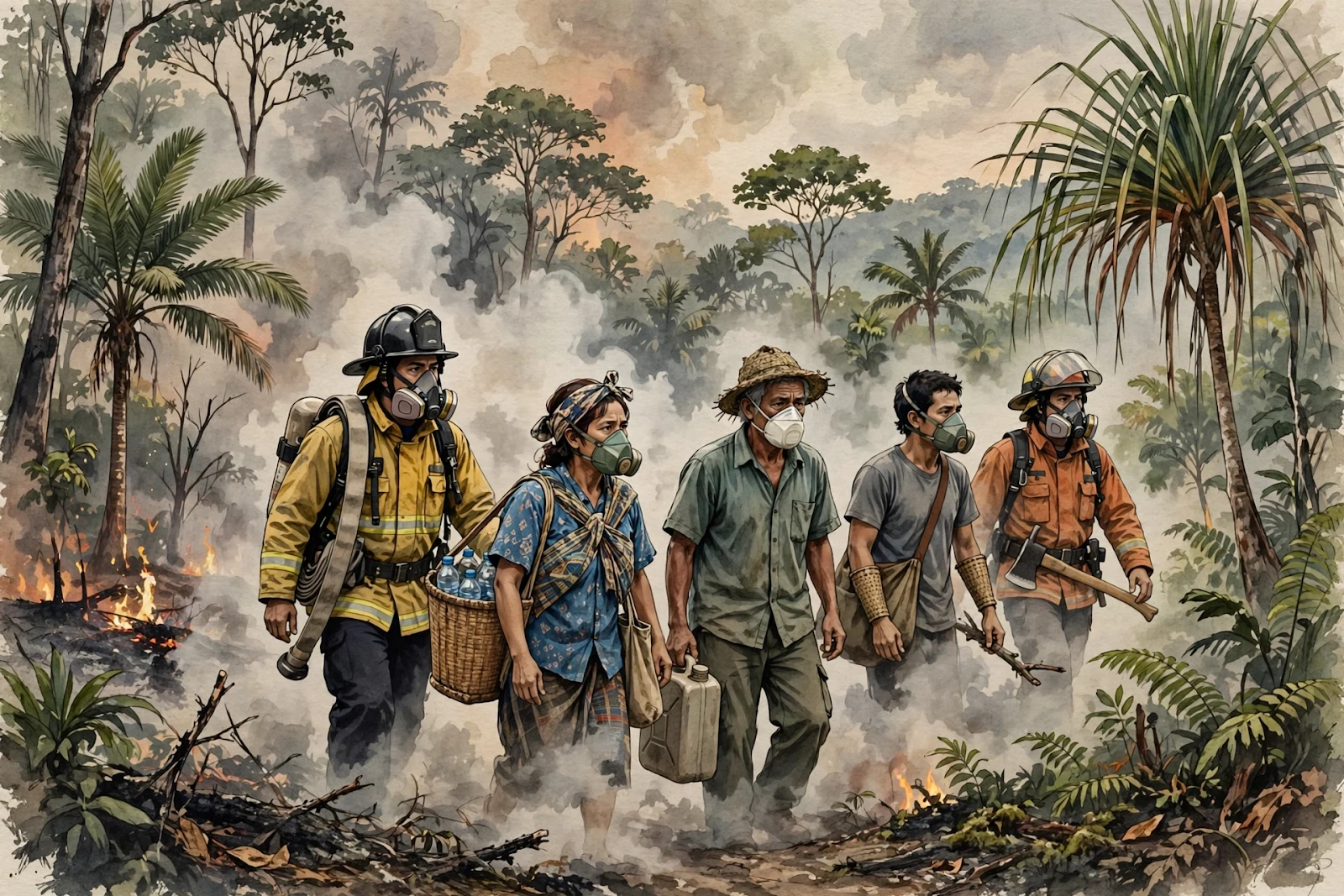
Illustration: Firefighters and villagers wearing protective masks moving through smoky haze near a forest fire edge.
Why It Matters
The health burden is immediate. Smoke that stays near the ground exposes people to unhealthy air for extended periods, even in communities far from the flames, because smoke can travel considerable distances. School closures, cancelled flights and mask advice are not just inconveniences: they signal days and weeks of exposure for children, older people and anyone with breathing difficulties, and they disrupt education, health care and livelihoods in communities already strained by drought, water shortages and crop failures.
The climate burden is longer lasting. When forests burn, carbon stored in vegetation and soil is released into the atmosphere, adding to the warming that makes droughts more likely. The 2026 season therefore acts as a feedback loop: El Niño dries the landscape, fires release carbon, and the resulting warming raises the odds of future dry, fire-prone seasons. That is why scientists track fire emissions so closely — a record year in one island's forests is a measurable addition to the global carbon budget.
The ecological stakes are equally high. New Guinea's forests are among the most biologically diverse on Earth, and repeated or severe fires can permanently change savannas and rainforests, pushing out species that cannot recover. When fire follows deforestation, the damage compounds: cleared land dries faster, burns more easily and is less likely to return to forest, locking in a drier, more flammable landscape for years.
There is also a warning for the wider region. The 2026 season shows that fire risk is shifting geographically — eastern Indonesia and New Guinea bore the brunt this year while western Indonesia was comparatively quieter. Fire prevention, early warning and land-use rules that worked for one region's fire seasons may not fit the new frontier, and the record emissions suggest the current season has already outpaced the response in the worst-hit areas.
What Happens Next
The immediate question is whether rain returns in time to dampen the remaining fires. El Niño conditions evolve over months rather than days, and forecasters will watch Pacific sea-surface temperatures and regional rainfall closely through the end of 2026. A return of regular rain would ease smoke and fire risk, but it would not undo the carbon already released or the forest already lost.
Scientists will also update the GFED totals as the season closes. If Papua New Guinea's total passes its 1997 record, as van der Werf said was very likely, 2026 will enter the record books as the island's worst fire-emissions year — a benchmark that future fire seasons and climate assessments will cite. Final tallies for Indonesian Papua will similarly show whether it climbs past its 2015 total.
For communities, the next steps are recovery and prevention: restoring water supplies, assessing crop and health damage, and deciding how land burning is managed before the next dry season. Researchers cited by NASA argue that treating fire as a land-use problem — not only a weather problem — is essential, because human-set fires in a parched landscape are the spark that turns drought into disaster.
Finally, the New Guinea fires will feed into global climate discussions. With the COP31 climate talks due to begin on November 9, 2026, according to Reuters, the record emissions from a single island's fire season are a concrete example of how drought, deforestation and warming interact — and of why forest protection is now framed as climate policy, not only conservation.

Illustration: A lush tropical rainforest canopy in New Guinea, with a distant plume of wildfire smoke rising beyond the trees.
Sponsored: explore today's featured sponsored offers
FAQ
Where is New Guinea and why is it burning?
New Guinea is the world's second-largest island, split between Papua New Guinea in the east and Indonesian Papua in the west. A strong El Niño brought severe drought in 2026, drying vegetation so that human-set fires for farming, hunting and land clearing spread out of control.
How much carbon have the fires released?
According to the Global Fire Emissions Database, fires in Papua New Guinea had released nearly 32 million tonnes of carbon by October 17, 2026 — a record for that point in the year — while Indonesian Papua had passed 35 million tonnes.
How does the smoke affect people's health?
Much of the smoke stays near the ground, causing air quality problems for extended periods. NASA reported flight delays and cancellations, school closures and advice for children and older people to wear masks.
Why are 1997 and 2015 used as comparisons?
Both were strong El Niño years with severe fires across parts of the Asia-Pacific region, and they set the previous records for fire emissions in the region. Researchers say 2026 is very likely to surpass 1997 in Papua New Guinea.
What would stop the fires?
Sustained rainfall would dampen fire activity, but longer-term prevention depends on managing land burning and deforestation, since cleared, dried land burns more easily in the next dry season.
Sources
- NASA Earth Observatory, "Fires Char New Guinea," October 22, 2026.
- NASA reporting on Indonesia's forest and land fires, via CNBC Indonesia, October 25–26, 2026.
- Global Fire Emissions Database (GFED) figures cited by NASA, October 2026.
Comments
Post a Comment